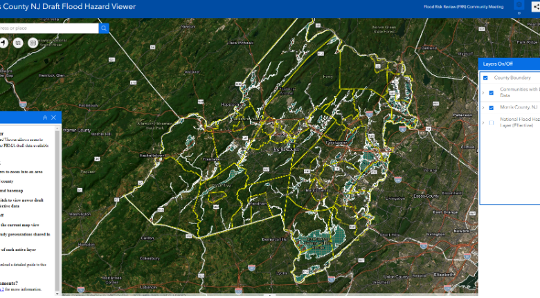
MORRIS COUNTY, N.J. — The Federal Emergency Management Agency is inviting the public to review proposed updates to flood maps in Morris County during a 90-day appeal and comment period that could affect properties near special flood hazard areas.
The appeal and comment period began Sept. 25 and is the latest step in a flood mapping process that has been underway for several years. Residents, business owners and other interested parties are encouraged to review the revised preliminary Flood Insurance Rate Maps to better understand local flood risks and potential future flood insurance requirements.
FEMA released revised preliminary Flood Insurance Rate Maps for Morris County on Nov. 17, 2025. Public open houses were held in January to allow people to review the preliminary maps.

The updated maps were developed in coordination with local, state and federal officials. Before the maps become final, eligible communities and other interested parties can identify potential errors and submit appeals or written comments.
An appeal can be submitted when someone believes the technical or scientific information used to develop a flood map is incorrect. Appeals must include technical information, such as hydraulic or hydrologic data, supporting the claim.
Written comments can be submitted for errors that do not affect flood hazard information, such as a missing or misspelled road name within a Special Flood Hazard Area or an incorrect municipal boundary.
Not all Morris County communities or map panels are eligible for the current appeal process. Panels that became effective Aug. 19, 2025, are not included. The current appeal period applies only to communities that received revised preliminary map panels as part of the Nov. 17, 2025, partial countywide update.
The preliminary maps can be reviewed through FEMA’s Flood Map Viewer for Morris County. The revised maps, flood insurance study report and associated data are also available through FEMA’s online mapping resources.
Appeals and written comments should be submitted through the appropriate municipal floodplain administrator. They may also be submitted directly to FEMA and the New Jersey Department of Environmental Protection.
After the 90-day period ends, FEMA will review and resolve submitted appeals and comments before notifying communities of the effective date of the final maps.
The new Flood Insurance Rate Maps are currently expected to take effect in late 2027 or early 2028, along with any applicable flood insurance requirements. The timeline could change depending on the appeal review process.
Most homeowners insurance policies do not cover flooding, according to FEMA. Property owners newly mapped into a high-risk flood zone may have options available to reduce flood insurance costs.
For questions about the flood mapping process, contact FEMA Region 2 Office of External Affairs at 212-680-3699 or FEMA-R2-ExternalAffairs@fema.dhs.gov. Residents also may contact Morris County Flood Mitigation Program Coordinator Mike DiGiulio at mdigiulio@co.morris.nj.us.
For general questions about FEMA flood maps, the public can contact a FEMA Map Specialist at 1-877-336-2627 or FEMA-FMIX@fema.dhs.gov.