MORRIS COUNTY, N.J. — The Morris County Board of County Commissioners has formally adopted an updated official county map, replacing a version last revised in 2007 and providing a modernized planning tool for local and county government decision-making.
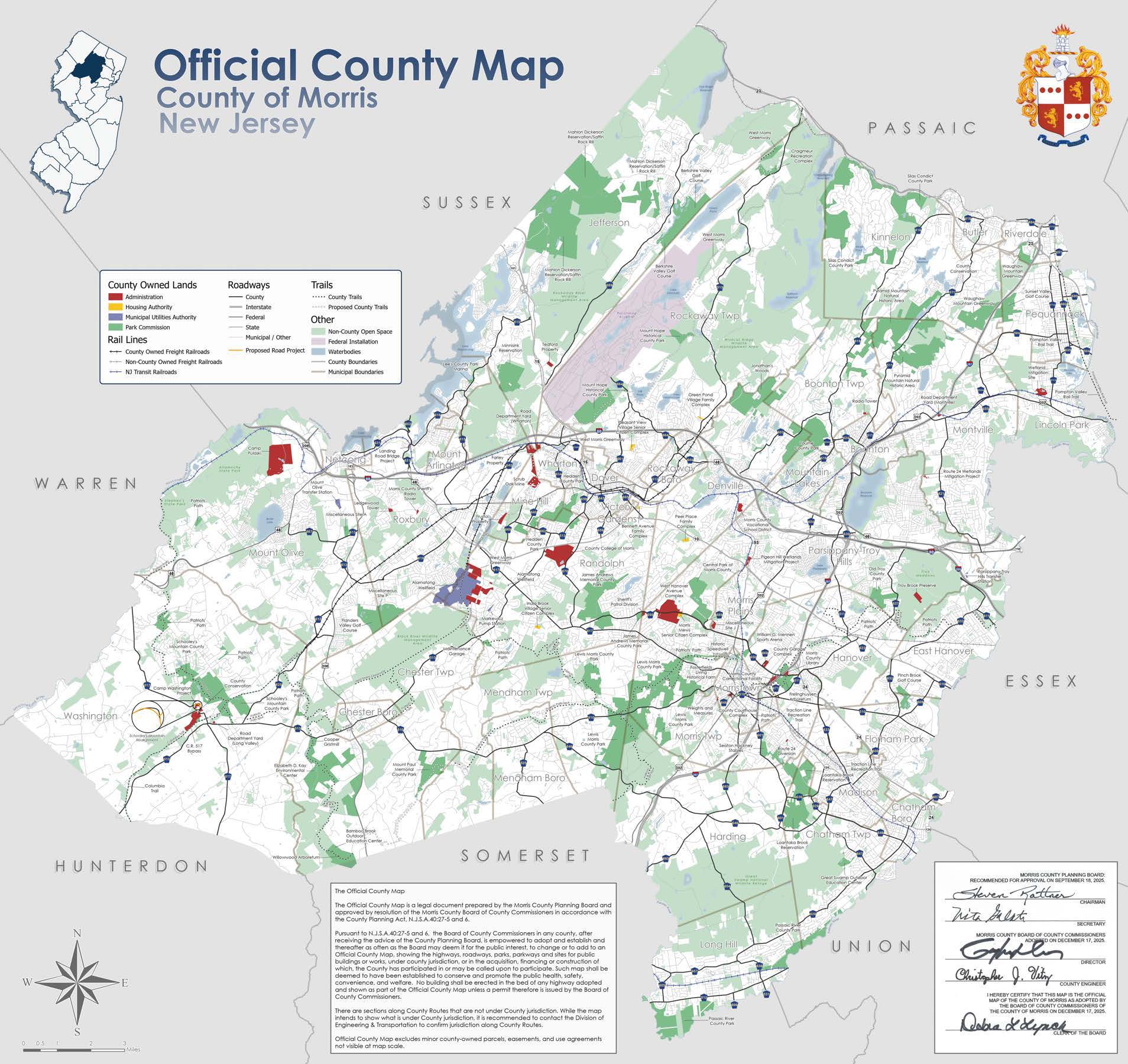
The new Official Morris County Map identifies key elements of the county’s current landscape, including highways, roadways, parks, greenways, public buildings and public works sites under county jurisdiction. It also shows areas where the county has participated, or may be involved, in land acquisition, financing or construction efforts.
“The official county map is a foundational planning document that reflects how Morris County has evolved and continues to grow. This update ensures the map accurately represents current conditions and supports sound planning, coordination and decision-making across all levels of government,” said County Commissioner Director Stephen H. Shaw, a board liaison to the Office of Planning and Preservation.

The update was led by the Morris County Office of Planning and Preservation and followed a yearlong review process that included land-use analysis, coordination with municipal and county agencies, and opportunities for public input. The effort concluded with two public hearings held last month and formal adoption of the map by the county commissioners on Dec. 17.
“The updated map provides local officials, planners and the public with a reliable reference that reflects current land use, infrastructure and county assets,” said Joe Barilla, director of the Office of Planning and Preservation. “The process to update the map was thorough and collaborative, and we are proud to share this new planning resource with municipalities and the public.”
Written notice of the proposed revisions and public hearings was provided to county and municipal agencies, including the county engineer, planning board, park commission, municipal clerks and planning boards, the Morris County Municipal Utilities Authority and the Office of Planning and Preservation. Public notice of the hearings was published in the Daily Record on Nov. 3, Nov. 10 and Nov. 17, 2025.
The Morris County Planning Board also reviewed the proposed revisions and provided advisory input as required by state law. County officials said all testimony and written comments submitted during the public hearing process were considered by the Board of County Commissioners before the map was adopted.